The story
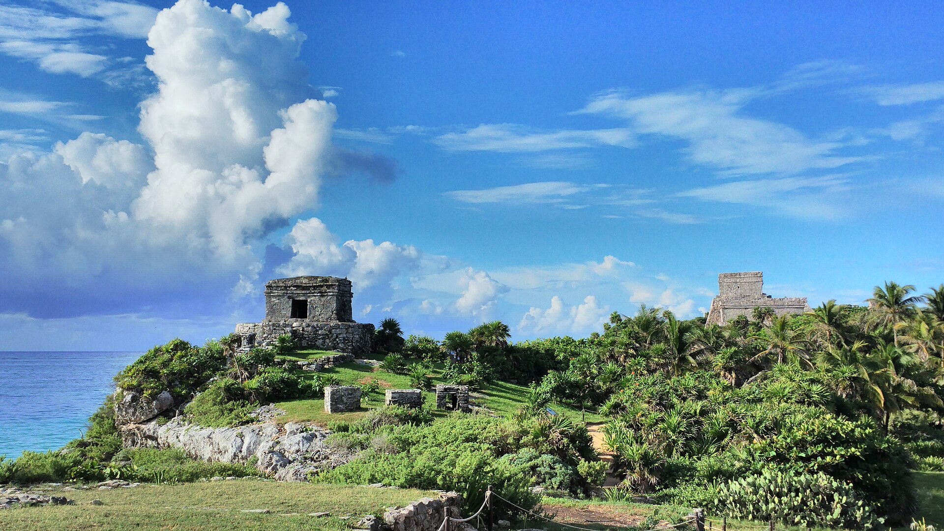
Tulum was a Maya port city, busiest from about 1200 to 1500 CE. It was surrounded on three sides by a stone wall, with the sea guarding the fourth side. Its old name may have been Zama, which means dawn, because it faces the sunrise.
Tulum was a trading hub. Large canoes carried goods along the coast, including jade, obsidian, cotton, cacao and turquoise from far away. A temple on the cliff called El Castillo may have worked like a lighthouse, helping canoes find the gap in the reef.
The Temple of the Frescoes has painted walls showing gods, and the Temple of the Descending God shows a figure diving headfirst from the sky. Spanish sailors saw Tulum in 1518 and said it was as big as a city in Spain.
How it ended
After the Spanish arrived, diseases they brought killed many people. Tulum was abandoned within about 70 years. Maya people still live in the region and some visited the site for ceremonies.
What life was like
Tulum's leaders and priests lived inside the walls, while most people lived outside. Traders arrived by canoe from the sea and by land. People fished, grew corn and traded salt and honey. Walls with watchtowers protected the town. Painters decorated temples with bright colors.
Wow facts
- Tulum is one of the few Maya cities built right beside the sea.
- A carved figure diving headfirst is called the Descending God.
- Spanish sailors spotted Tulum from their ships in 1518.
Photos
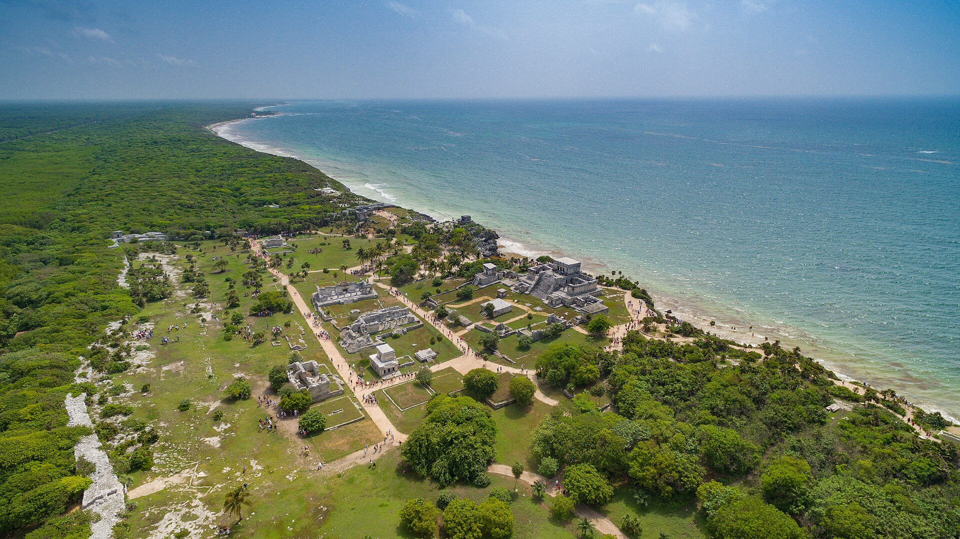 Mexiko Dronepicr, CC BY 3.0
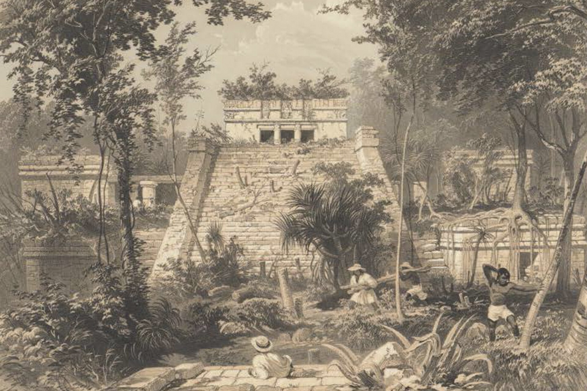 Tulum, lithograph published by Frederick Catherwood in 1844 Frederick Catherwood, Public domain
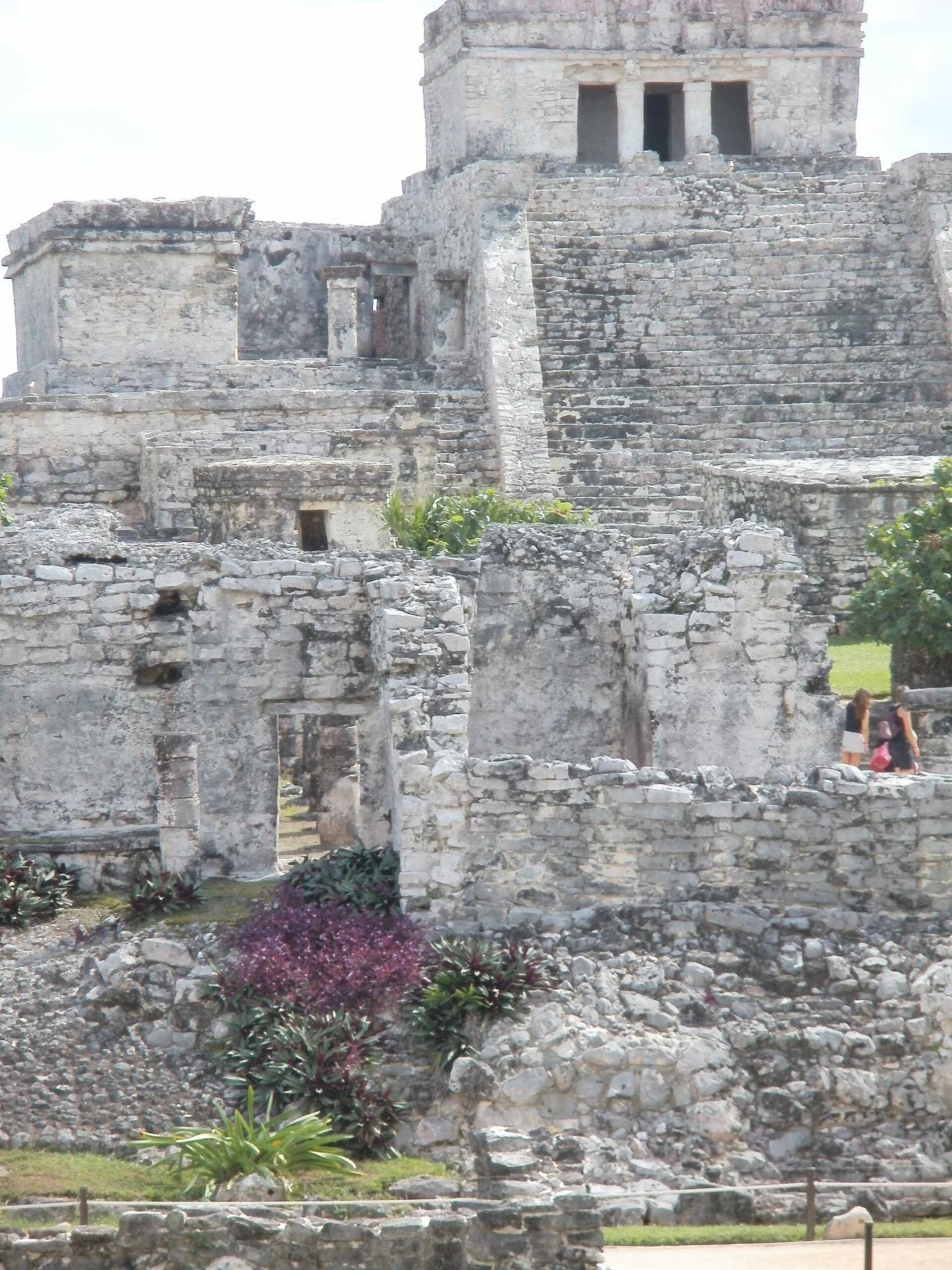 View to the top of El Castillo Amber Funderburk Vyn, CC BY-SA 4.0
Relics and treasures
- El Castillothe clifftop temple facing the sea, at the site
- Temple of the Frescoesa temple with painted walls, at the site
- Temple of the Descending Goda temple with a diving figure, at the site
- City wallthe stone wall with watchtowers, at the site
How we know
Spanish explorers wrote about Tulum in 1518. Stephens and Catherwood drew it in the 1840s. Archaeologists studied the murals, buildings and trade goods, which show Tulum's place in coastal trade.
What you would see today
Tulum is one of Mexico's most visited ruins. Visitors walk among temples, look out over the sea, and swim at the beach below. Iguanas lie on the stones everywhere.
For teachers and classrooms
Suggested level: grades 3-5. Print this page as a lesson sheet with the story, vocabulary, discussion questions and a quiz with an answer key.
Key words
- port
- a town where boats load and unload goods
- fresco
- a painting made on wet plaster
- reef
- a ridge of rock or coral near the surface of the sea
Talk about it
- Why might a city want to be built beside the ocean?
- How could a temple help sailors find their way?
Try this activity
- Draw a map of Tulum as it looked at its busiest, and label three things people did there.
- Find Tulum on the Ruinscape timeline, then pick another place from the same century and compare them.
- Use one link in Sources below to find a real object from this place. Describe what it is made of and what it tells us.
Quick quiz
What is special about Tulum's location?
- It is on a cliff by the sea
- It is on a mountain peak
- It is underground
- It is in a desert
Show the answer
A. Tulum sits on a cliff above the Caribbean.
What may El Castillo have helped with?
- Guiding canoes like a lighthouse
- Storing gold
- Making rain
- Growing corn
Show the answer
A. It may have helped canoes find the gap in the reef.
When did Spanish sailors first see Tulum?
- 1518
- 1066
- 1900
- 800
Show the answer
A. They spotted it from their ships in 1518.
Sources and further reading
Ruinscape lessons are written for students and checked against encyclopedia and museum records. Go to the sources: these links search real museum collections, the UNESCO list and research by archaeologists.
- Wikipedia articleEncyclopedia overview with its own references
- UNESCO World HeritageOfficial listing, if the site is protected
- Google Arts & CultureMuseum exhibits, virtual tours and close-up photos
- British Museum collectionReal objects, photos and catalog notes
- The Met collectionObjects and essays from the Metropolitan Museum of Art
- Smithsonian collectionsU.S. national museum records
- 3D models on SketchfabScans of sites and artifacts (check each license)
- Scholarly articlesResearch papers by archaeologists and historians
Read the full background
Tulum (Spanish pronunciation: [tuˈlun]; Yucatec Maya: Tulu'um) is the site of a pre-Columbian Mayan walled city which served as a major port for Coba, in the Mexican state of Quintana Roo. The ruins are situated on 12-meter-tall (39 ft) cliffs along the east coast of the Yucatán Peninsula on the Caribbean Sea. Tulum was one of the last cities built and inhabited by the Maya and achieved its greatest prominence between the 13th and 15th centuries. Maya continued to occupy Tulum for about 70 years after the Spanish began exploring Mexico, but the city was abandoned by the end of the 16th century. Tulum is one of the best-preserved coastal Maya sites, and today it is a popular site for tourists.
Background text from Wikipedia, available under CC BY-SA 4.0.
Last updated: October 2026. How we make Ruinscape.