The story
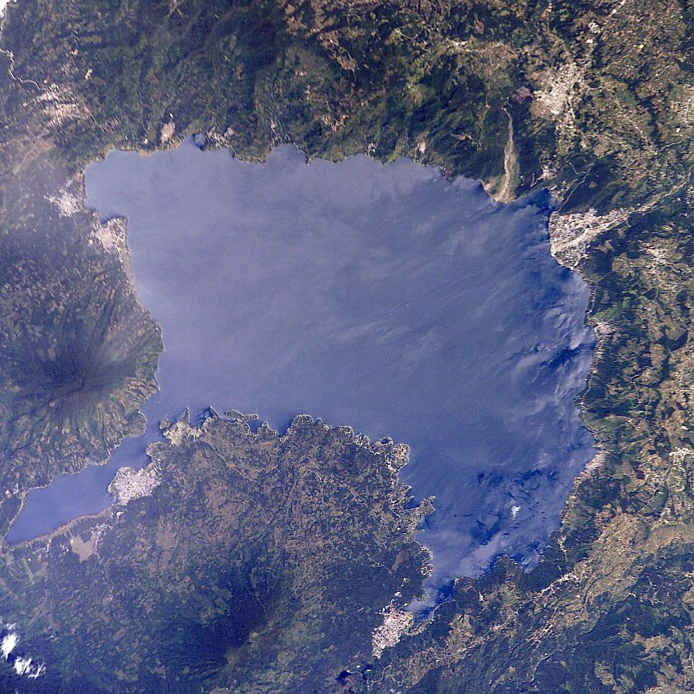
Lake Atitlan sits in a giant volcanic crater in the highlands of Guatemala. About 2,000 years ago, during the Maya Preclassic period, the lake was lower. A small island near its southern shore held a town called Samabaj.
The town had houses, a ceremonial area, stone monuments called stelae, and altars. It may have been a place of pilgrimage. Pottery found here dates mostly to around 100 BCE to 250 CE.
Then the lake rose. Lake Atitlan has no river flowing out of it, so its level goes up and down with rain and underground drainage. As the water climbed, the people left, and Samabaj sank beneath the surface.
How it went under
The lake level rose, perhaps over a short time, and covered the island. People left before it was swallowed. The ruins have been underwater ever since.
What life was like
People at Samabaj fished, grew crops on the shore, and made pottery and stone tools. They used obsidian from volcanic sources. The ceremonial area suggests people gathered for rituals, possibly linked to the sacred lake and volcanoes. Canoes would have been the main way to travel.
Wow facts
- The ruins lie about 15 meters or more below the lake's surface.
- A local diver named Roberto Samayoa found the site in 1996, and the name Samabaj comes partly from his name.
- The lake has no river outlet, so its level can change a lot.
Photos
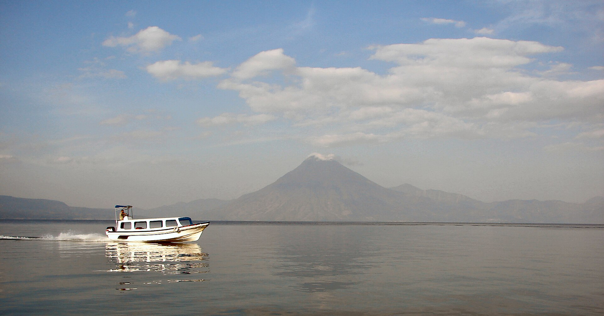 Volcan San Pedro as seen in the morning from the lakeshore at Panajachel. Uspn, CC BY-SA 3.0
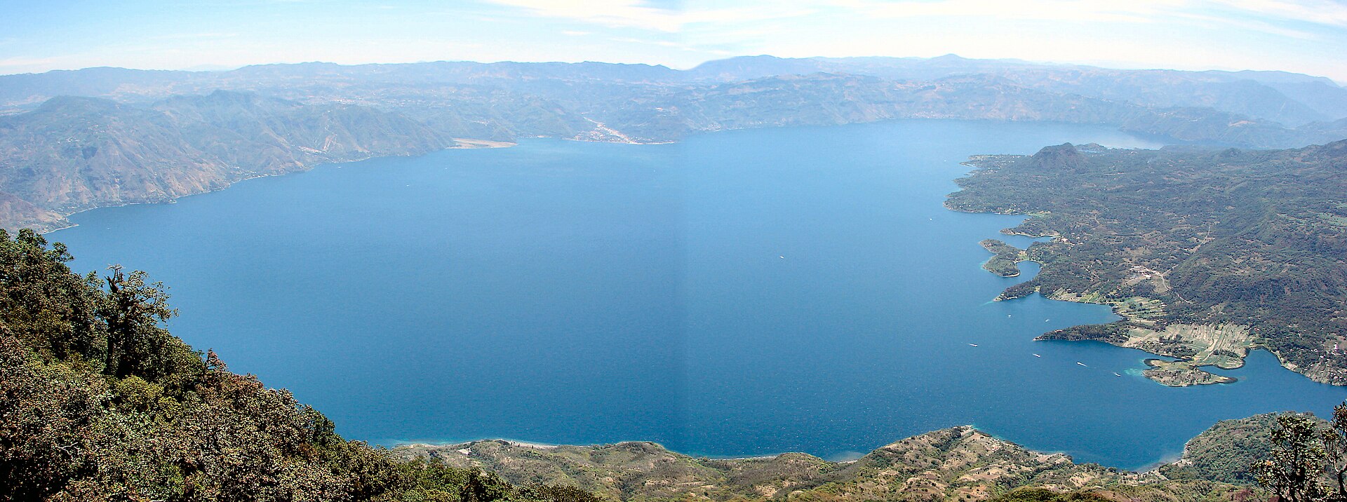 Lago Atitlan as seen from the top of Volcan San Pedro. The top is at 3018 metres above... Bjørn Christian Tørrissen, CC BY-SA 3.0
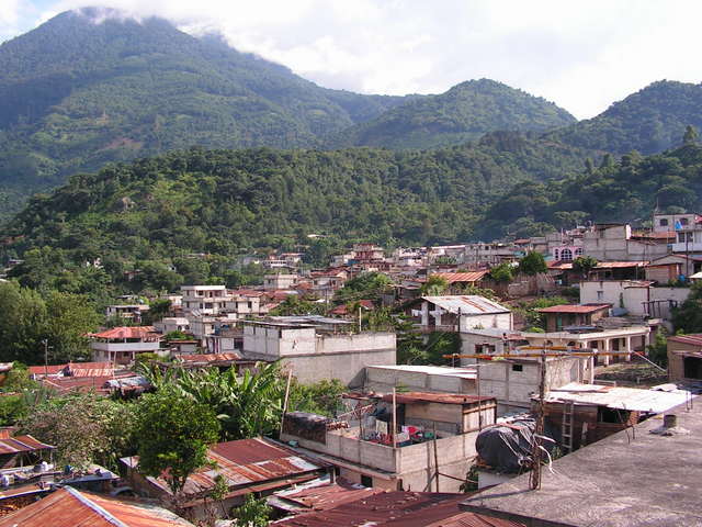 San Pedro la Laguna and Volcan San Pedro, Guatemala. Axcordion at English Wikipedia, Public domain
Relics and treasures
- Underwater stelaecarved stone monuments on the lake floor, at the site
- Ceremonial areaplatforms and altars, under the lake
- Potteryancient vessels raised for study, kept by Guatemalan researchers
- Stone wallshouse and building foundations, under the lake
How we know
After Roberto Samayoa's find, archaeologist Sonia Medrano and her team mapped the site with divers. Pottery styles helped date it. Geologists study the lake's changing water level.
What you would see today
Samabaj is studied by underwater archaeologists from Guatemala. It is not open for tourist diving, to protect it. Lake Atitlan's towns and Maya communities are popular to visit.
For teachers and classrooms
Suggested level: grades 6-8. Print this page as a lesson sheet with the story, vocabulary, discussion questions and a quiz with an answer key.
Key words
- crater
- a large bowl-shaped hole, here left by an old volcano
- Preclassic
- an early period of Maya history, before the great Classic cities
- underwater archaeology
- the study of past human life found underwater
Talk about it
- Why might rising water force people to move, both long ago and today?
- Why do archaeologists sometimes keep sites closed to visitors?
Try this activity
- Draw a map of Samabaj as it looked at its busiest, and label three things people did there.
- Find Samabaj on the Ruinscape timeline, then pick another place from the same century and compare them.
- Use one link in Sources below to find a real object from this place. Describe what it is made of and what it tells us.
Quick quiz
Where is Samabaj?
- Under Lake Atitlan in Guatemala
- In the desert of Egypt
- On a mountain in Peru
- Under the Arctic ice
Show the answer
A. Samabaj is beneath Lake Atitlan.
Why did Samabaj sink?
- The lake rose
- An earthquake pushed it into the sea
- A meteor hit it
- A dam broke
Show the answer
A. Rising lake water covered the island.
Who found Samabaj in 1996?
- A local diver
- An astronaut
- A king
- A fisherman's cat
Show the answer
A. Diver Roberto Samayoa found it.
Sources and further reading
Ruinscape lessons are written for students and checked against encyclopedia and museum records. Go to the sources: these links search real museum collections, the UNESCO list and research by archaeologists.
- Wikipedia articleEncyclopedia overview with its own references
- UNESCO World HeritageOfficial listing, if the site is protected
- Google Arts & CultureMuseum exhibits, virtual tours and close-up photos
- British Museum collectionReal objects, photos and catalog notes
- The Met collectionObjects and essays from the Metropolitan Museum of Art
- Smithsonian collectionsU.S. national museum records
- 3D models on SketchfabScans of sites and artifacts (check each license)
- Scholarly articlesResearch papers by archaeologists and historians
Read the full background
Lake Atitlán (Spanish: Lago de Atitlán, [atiˈtlan]) is a large natural lake in the Guatemalan Highlands of the Sierra Madre mountain range. The lake is located in the Sololá Department of southwestern Guatemala. With a maximum depth of 340 metres (1,120 ft), it is the deepest lake in Central America.
Background text from Wikipedia, available under CC BY-SA 4.0.
Last updated: October 2026. How we make Ruinscape.