The story
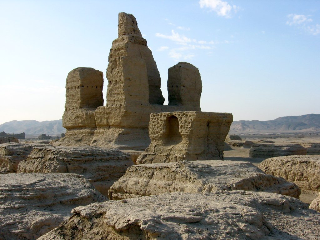
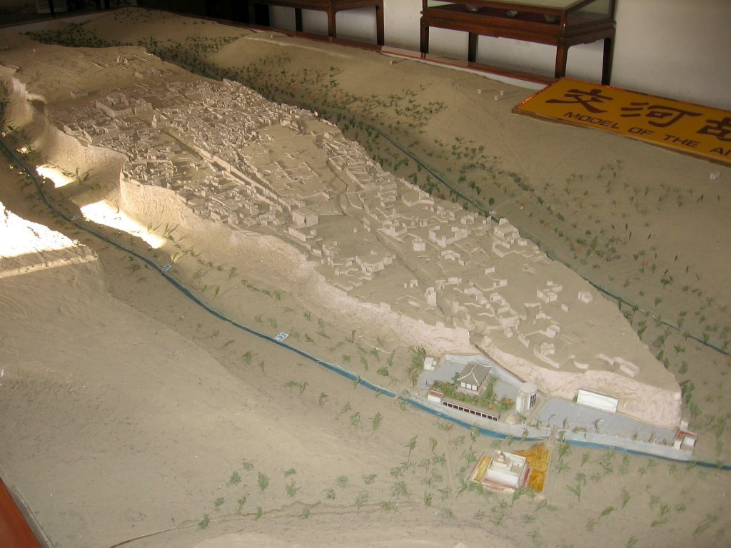
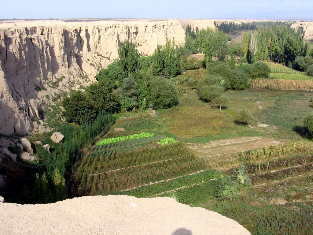
Jiaohe sits on a leaf-shaped plateau about 1.6 kilometers long, with steep cliffs dropping to rivers on both sides. That made it a natural fortress. From around the 2nd century BCE, it was the capital of the Jushi Kingdom, a stop on the Silk Road.
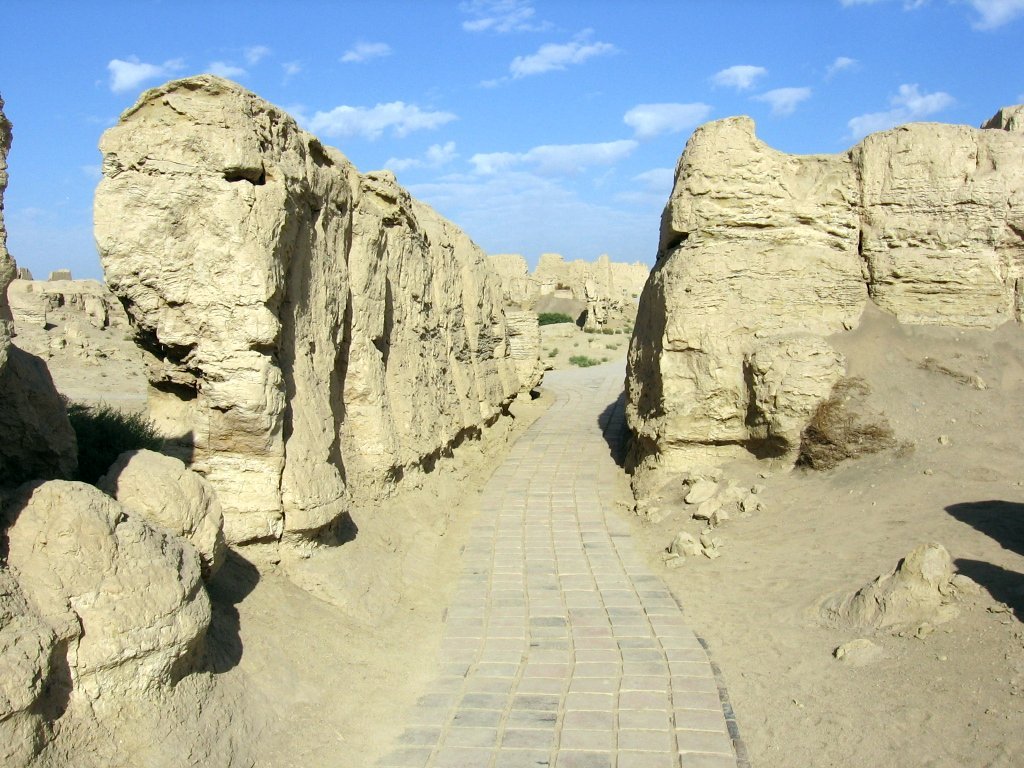
Instead of stacking bricks, people dug down into the hard, packed earth to make streets, homes and courtyards. Some walls were then built higher with rammed earth.
Later, the Tang dynasty of China set up an important government office here to control the region. Jiaohe had Buddhist temples, a central avenue, and houses packed close together.
How it ended
Jiaohe was badly damaged in wars in the 1300s, when Mongol armies fought over the region. People left, and the empty earth city has been dried and shaped by wind ever since.
What life was like
People in Jiaohe farmed using water from the rivers and underground channels called karez. Turpan is one of the hottest and driest places in China, so homes carved into the earth stayed cooler. Merchants traded on the Silk Road. Monks lived in temple compounds. Archaeologists found a cemetery with many children's graves.
Wow facts
- The city was carved downward instead of built upward.
- Turpan is one of the hottest places in China, sometimes over 45 degrees Celsius in summer.
- Underground water channels called karez still bring water from the mountains.
Photos
 Turfan (Turpan/Tulufan) is an oasis city in the Xinjiang Uygur Autonomous Region of the... Colegota, CC BY-SA 2.5 es
 Turfan (Turpan/Tulufan) is an oasis city in the Xinjiang Uygur Autonomous Region of the... Colegota, CC BY-SA 2.5 es
 Turfan (Turpan/Tulufan) is an oasis city in the Xinjiang Uygur Autonomous Region of the... Colegota, CC BY-SA 2.5 es
Relics and treasures
- Main avenuethe central street carved through the city, at the site
- Great Monasterya large Buddhist temple compound, at the site
- Pagoda forestthe remains of many small stupas, at the site
- Silk Road findsobjects from Jiaohe, in the Turpan Museum
How we know
Chinese records describe the Jushi Kingdom and the Tang offices here. Archaeologists have mapped and excavated the city since the early 1900s. Very dry air helped preserve walls and objects.
What you would see today
Visitors walk the main avenue from the south gate to a large Buddhist temple at the north end. The dry climate has preserved the earth walls. Jiaohe is part of the Silk Roads UNESCO World Heritage Site.
For teachers and classrooms
Suggested level: grades 6-8. Print this page as a lesson sheet with the story, vocabulary, discussion questions and a quiz with an answer key.
Key words
- plateau
- a flat area of high ground
- rammed earth
- soil packed down hard to make walls
- Silk Road
- ancient trade routes linking China with Central Asia, the Middle East and Europe
Talk about it
- What are the advantages of carving a city into the ground in a hot desert?
- Why would a town on a trade route become important to empires?
Try this activity
- Draw a map of Jiaohe Ruins as it looked at its busiest, and label three things people did there.
- Find Jiaohe Ruins on the Ruinscape timeline, then pick another place from the same century and compare them.
- Use one link in Sources below to find a real object from this place. Describe what it is made of and what it tells us.
Quick quiz
How was Jiaohe built?
- By carving down into the earth
- With stone blocks
- With wood
- With glass
Show the answer
A. People dug streets and rooms down into the ground.
What made Jiaohe a natural fortress?
- Cliffs and rivers on both sides
- A moat of lava
- Ice walls
- A forest
Show the answer
A. The plateau had steep cliffs above two rivers.
What trade route passed by Jiaohe?
- The Silk Road
- The Amber Road
- Route 66
- The Inca Road
Show the answer
A. Jiaohe was a stop on the Silk Road.
Sources and further reading
Ruinscape lessons are written for students and checked against encyclopedia and museum records. Go to the sources: these links search real museum collections, the UNESCO list and research by archaeologists.
- Wikipedia articleEncyclopedia overview with its own references
- UNESCO World HeritageOfficial listing, if the site is protected
- Google Arts & CultureMuseum exhibits, virtual tours and close-up photos
- British Museum collectionReal objects, photos and catalog notes
- The Met collectionObjects and essays from the Metropolitan Museum of Art
- Smithsonian collectionsU.S. national museum records
- 3D models on SketchfabScans of sites and artifacts (check each license)
- Scholarly articlesResearch papers by archaeologists and historians
Read the full background
The Jiaohe ruins, known by the local Uyghur populace as Yarghul, is a ruined city in the Yarnaz Valley, 10 km (6.2 mi) west of the city of Turpan in Xinjiang, China. It was the capital of the Tocharian kingdom of Jushi. It is a natural fortress located atop a steep cliff on a leaf-shaped plateau between two deep river valleys, and was an important stop along the Silk Road.
Background text from Wikipedia, available under CC BY-SA 4.0.
Last updated: October 2026. How we make Ruinscape.