No. 129
Blinkerwall

- Where
- Baltic Sea, Germany
- Built by
- Stone Age hunters
- Era
- about 11,000 years ago
- Known for
- A stone wall over half a mile long, likely used to herd reindeer; announced in 2024.
- How it went under
- Drowned when the Baltic rose.

Lyra Kael can take you here on the globe, tell you the story out loud and answer your questions. Start the time jump.
Background
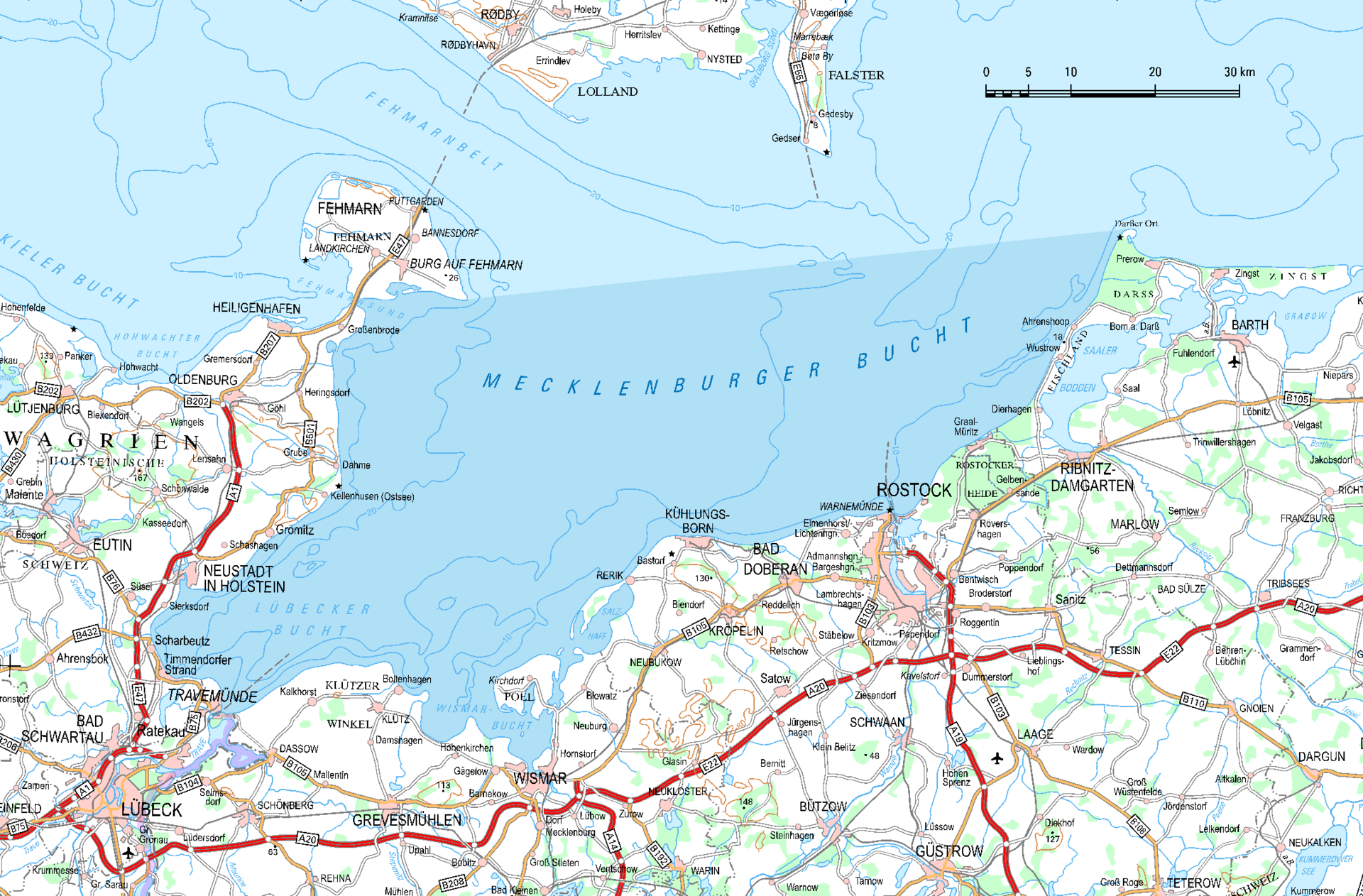
The Bay of Mecklenburg (German: Mecklenburger Bucht or Mecklenburgische Bucht; Danish: Mecklenburg Bugt), also known as the Mecklenburg Bay or Mecklenburg Bight, is a long narrow basin making up the southwestern finger-like arm of the Baltic Sea, between the shores of Germany to the south and the Danish islands of Lolland, Falster, and Møn to the north, the shores of Jutland to the west, and joining the largest part of the Baltic to the east.
The Bay of Mecklenburg, which includes the Bay of Wismar and the Bay of Lübeck, connects to the Bay of Kiel in the northwest. Notable ports in the bay are Lübeck, Rostock and Wismar.
Text from Wikipedia, licensed CC BY-SA 4.0.